ISS TRANSIT TRACKS
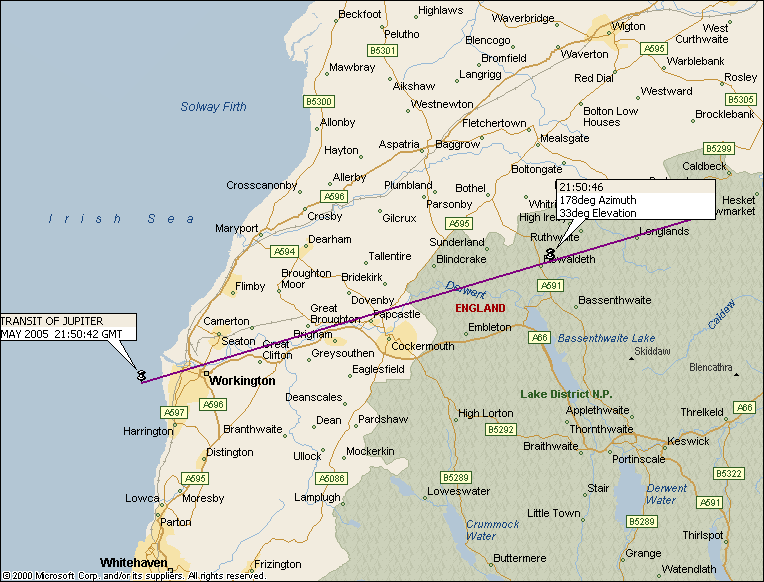
To help me in my attempt to image ISS Transits of the Sun Moon or Planets, I will from time to time display here maps showing the centre lines of transits occuring close to my home location, of the International Space Station. Note that the transits are very short, lasting typically a second or two at most and the ISS will typically appear less than 1/200 the size of the Sun or Moon.
The data is from alerts provided by http://iss-transit.sourceforge.net and the maps are produced using Microsoft Autoroute. I can also supply the map as an Autoroute .axe file by e-mail on request.
The maps typically show the Lat/Long at two positions along the track, the width of the track (Sun and Moon only - the planet tracks are less than 100m wide!), the date and time (GMT), the type of transit, and the elevation.
The accuracy of the track depends on the accuracy of the orbital elements. I will attempt to update any graphs on the run up to an event if I get more up to date information. I am not however responsible for anyone taking time off work, travelling great distances etc and missing an event because of inaccuracies in this map!
NOTE JUPITER TRANSIT !
Map based in information received 5th May 2005
